Peti dibuka
+${chestReward.xp} XP
Explorer
NOUVEAU ×${chestReward.collectible.quantity}
tapez pour fermer

Lihat monumen di sekitar Anda dalam AR Buka peti di aplikasi

Around Us dibuat untuk ponsel Anda — arahkan kamera ke jalanan dan temukan monumen serta tempat-tempat di sekitar Anda dalam augmented reality. Around Us dibuat untuk ponsel Anda — peti terbuka saat Anda berjalan, menjelajah, dan mengabadikan tempat-tempat di sekitar.

•

Aktifkan Lokasi

Kami memerlukan lokasi Anda untuk menampilkan tempat-tempat menarik di sekitar Anda

Temukan tempat di sekitar

Temukan lokasi menarik dan permata tersembunyi di sekitar Anda

Petunjuk arah yang tepat

Dapatkan petunjuk arah dan jarak yang akurat ke berbagai tempat

Lokasi Anda tidak pernah dibagikan kepada pengguna lain. Lokasi hanya digunakan saat Anda mengetuk tombol lokasi.

Masuk ke akun Anda

Mulai menjelajah — gratis

Dipercaya oleh 90.583 pelancong di seluruh dunia

Lanjutkan dengan Google
Lanjutkan dengan Apple
atau

Kami akan mengirimkan kode kepada Anda untuk masuk

Dengan melanjutkan, Anda menerima Syarat dan Ketentuan serta Kebijakan Privasi kami

Periksa kotak masuk Anda

Kami telah mengirimkan kode PIN ke kotak masuk Anda. Silakan masukkan kode di bawah ini.

Simonside Hills
Diskusi Ulasan Foto
3,7 rb Popularitas

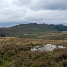
Simonside Hills, Hill chain in Northumberland, England

Panduan audio · Sekitar satu menit
Menyiapkan panduan audio Anda… Panduan audio tidak dapat dimuat, silakan coba lagi.Masuk untuk mendengarkan panduan audio

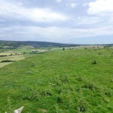
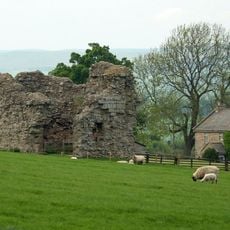
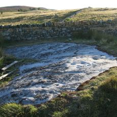
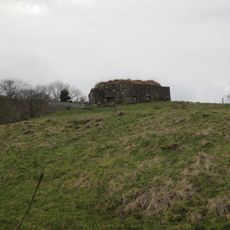
Simonside Hills is a sandstone ridge located near Rothbury in Northumberland, with peaks ranging from 300 to 440 meters in elevation and featuring rocky outcrops along the crest. The chain consists of several connected high points that hikers can reach via established paths offering views across the surrounding terrain.

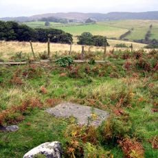
Bronze Age inhabitants left cup rings and burial sites on the hills, while an Iron Age hillfort at Lordenshaws indicates long-term human settlement in the region. These archaeological remains show that people lived in this landscape over thousands of years.

The name Simonside comes from Simundessete, recorded in the 13th century, and reflects connections to Germanic traditions. Today the hills serve mainly as a destination where walkers move through the landscape and take in views, with the old naming history visible only in written records.

Access to the hills is mainly via the Lordenshaw car park, from which marked trails lead to various high points. The walks vary in difficulty and offer views to the Cheviot Hills and the North Sea on clear days.

Local folklore tells of the Duergar, supernatural beings from Norse mythology, said to roam the hills at night carrying lanterns and leading travelers astray. These stories remain woven into the region's oral traditions and add a mysterious layer to the landscape.

Komunitas para pelancong yang penuh rasa ingin tahu

AroundUs menghimpun ribuan tempat pilihan, tips lokal, dan permata tersembunyi, yang diperkaya setiap hari oleh 60,000 kontributor di seluruh dunia.
Mulai menjelajah
Koordinat GPS
55.28100,-1.96200
Pembaruan terakhir
9 Oktober 2026 20:02
Di sekitar tempat ini
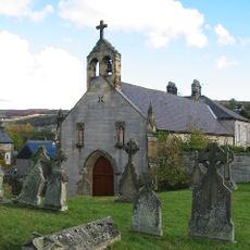
Roman Catholic Church of All Saints
Inggris Raya

Roman Catholic Church of All Saints

3.7 km
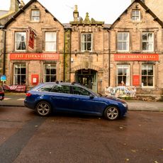
Turks Head Inn
Inggris Raya

Turks Head Inn

4.5 km
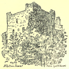
Whitton Tower
Inggris Raya

Whitton Tower

4 km
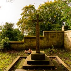
Monument To First Lord Armstrong At South West Of Detached Graveyard
Inggris Raya

Monument To First Lord Armstrong At South West Of Detached Graveyard

4.4 km
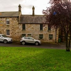
5, Market Place
Inggris Raya

5, Market Place

4.5 km
Rothbury Library
Inggris Raya

Rothbury Library

4.3 km
Monument To Walter Mavin At South East Of Detached Graveyard
Inggris Raya

Monument To Walter Mavin At South East Of Detached Graveyard

4.5 km
Rothbury
Inggris Raya

Rothbury

4.3 km
Sharpe's Folly
Inggris Raya

Sharpe's Folly

4.1 km
Tosson Burgh
Inggris Raya

Tosson Burgh

1.9 km
Highfield And Adjacent Cottage To East
Inggris Raya

Highfield And Adjacent Cottage To East

4.3 km
Ogle House
Inggris Raya

Ogle House

4.4 km
Milestone Circa 1 Mile South Of Rothbury
Inggris Raya

Milestone Circa 1 Mile South Of Rothbury

4.4 km
West End House
Inggris Raya

West End House

4.4 km
Tosson Tower
Inggris Raya

Tosson Tower

2 km
Round cairn on Garleigh Hill, 790m north east of Lordenshaw
Inggris Raya

Round cairn on Garleigh Hill, 790m north east of Lordenshaw

3.6 km
Milestone Circa A Quarter Of A Mile West Of Holling Hill
Inggris Raya

Milestone Circa A Quarter Of A Mile West Of Holling Hill

4.2 km
Conway House (Premises Of Rg Bolam And Son)
Inggris Raya

Conway House (Premises Of Rg Bolam And Son)

4.5 km
House Belonging To Mrs Armstrong  The Old Surgery
Inggris Raya

House Belonging To Mrs Armstrong The Old Surgery

4.4 km
Whitton Pant Circa 40 Yards North Of Whitton Tower
Inggris Raya

Whitton Pant Circa 40 Yards North Of Whitton Tower

4 km
Orchard Guest House
Inggris Raya

Orchard Guest House

4.4 km
Milestone Circa A Quarter Of A Mile East Of Lordenshaw
Inggris Raya

Milestone Circa A Quarter Of A Mile East Of Lordenshaw

3.8 km
Cup and ring marked rock and adjacent stone setting, 820m east of Whittondean Farm
Inggris Raya

Cup and ring marked rock and adjacent stone setting, 820m east of Whittondean Farm

4.1 km
Pill Box At Nu 035 012
Inggris Raya

Pill Box At Nu 035 012

2.7 km
Tosson Tower Farmhouse
Inggris Raya

Tosson Tower Farmhouse

2.1 km
Cup and ring marked rock, 940m south-west of Wagtail Farm
Inggris Raya

Cup and ring marked rock, 940m south-west of Wagtail Farm

4.4 km
East Newtown Farmhouse
Inggris Raya

East Newtown Farmhouse

2.5 km
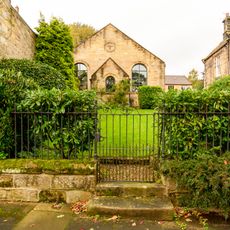
Former Congregational Church, Now Church Hall
Inggris Raya

Former Congregational Church, Now Church Hall

4.3 km
Tampilkan peta lengkap
Ulasan
Bagikan pengalaman Anda

Belum ada ulasan

Diskusi
Mulai diskusi...

Belum ada diskusi

« Simonside Hills - Hill chain in Northumberland, England » disediakan oleh Around Us (id.aroundus.com). Gambar dan teks berasal dari proyek Wikimedia di bawah lisensi Creative Commons. Anda diizinkan menyalin, mendistribusikan, dan memodifikasi salinan halaman ini, sesuai ketentuan yang ditetapkan oleh lisensi, selama catatan ini terlihat dengan jelas.

Temukan permata tersembunyi di mana pun Anda pergi!

Dari kafe tersembunyi hingga titik pandang yang menakjubkan, hindari tempat wisata yang ramai dan temukan tempat yang sesuai dengan gaya Anda. Aplikasi kami memudahkannya dengan pencarian suara, filter cerdas, optimasi rute, dan tips orang dalam dari para pelancong di seluruh dunia. Unduh sekarang untuk pengalaman seluler yang lengkap.
Around Us App Screenshot
❝

Cara unik untuk menemukan tempat-tempat baru❞

— Le Figaro

❝

Semua tempat yang layak dijelajahi❞

— France Info

❝

Ekskursi sesuai keinginan hanya dengan beberapa klik❞

— 20 Minutes

Around Us
Panduan Wisata & Peta
Unduh

Kirim ke ponsel Anda

QR Code
1

Buka aplikasi kamera di ponsel Anda.

2

Arahkan kamera ke kode QR. Sebuah notifikasi akan muncul.

3

Ketuk notifikasi untuk membuka tautan.