Peti dibuka
+${chestReward.xp} XP
Explorer
NOUVEAU ×${chestReward.collectible.quantity}
tapez pour fermer

Lihat monumen di sekitar Anda dalam AR Buka peti di aplikasi

Around Us dibuat untuk ponsel Anda — arahkan kamera ke jalanan dan temukan monumen serta tempat-tempat di sekitar Anda dalam augmented reality. Around Us dibuat untuk ponsel Anda — peti terbuka saat Anda berjalan, menjelajah, dan mengabadikan tempat-tempat di sekitar.

•

Aktifkan Lokasi

Kami memerlukan lokasi Anda untuk menampilkan tempat-tempat menarik di sekitar Anda

Temukan tempat di sekitar

Temukan lokasi menarik dan permata tersembunyi di sekitar Anda

Petunjuk arah yang tepat

Dapatkan petunjuk arah dan jarak yang akurat ke berbagai tempat

Lokasi Anda tidak pernah dibagikan kepada pengguna lain. Lokasi hanya digunakan saat Anda mengetuk tombol lokasi.

Masuk ke akun Anda

Mulai menjelajah — gratis

Dipercaya oleh 90.512 pelancong di seluruh dunia

Lanjutkan dengan Google
Lanjutkan dengan Apple
atau

Kami akan mengirimkan kode kepada Anda untuk masuk

Dengan melanjutkan, Anda menerima Syarat dan Ketentuan serta Kebijakan Privasi kami

Periksa kotak masuk Anda

Kami telah mengirimkan kode PIN ke kotak masuk Anda. Silakan masukkan kode di bawah ini.

Lambeth Marsh
Diskusi Ulasan Foto
4,4 rb Popularitas

Lambeth Marsh, District on the South Bank in London, England

Panduan audio · Sekitar satu menit
Menyiapkan panduan audio Anda… Panduan audio tidak dapat dimuat, silakan coba lagi.Masuk untuk mendengarkan panduan audio

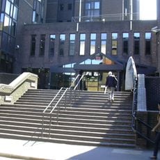
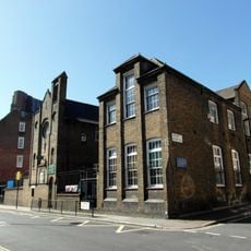
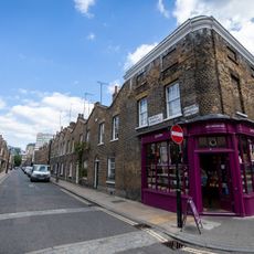
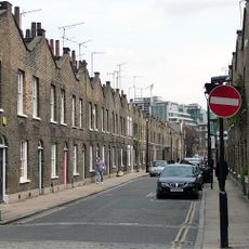
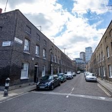
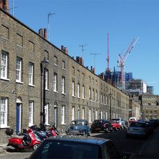
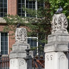
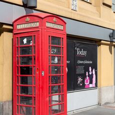
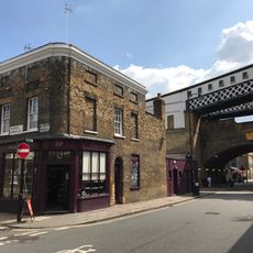
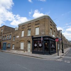
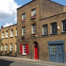
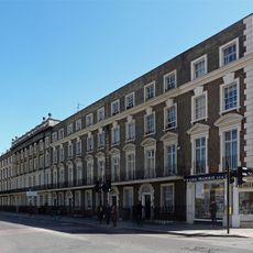
Lambeth Marsh is a district on London's South Bank, occupying ground that was once wetland between Waterloo and Lambeth. Its streets are relatively narrow, lined with Victorian terraces and a handful of older buildings, and the area centers on Lower Marsh, the main commercial street.

The area appears in the Domesday Book of 1086 and remained largely agricultural and difficult to build on for centuries because of the waterlogged ground. Drainage work carried out in the 1700s finally allowed construction to take hold, and the district gradually filled with the terraced streets still visible today.

Lower Marsh Market runs along the main street and draws a mix of local workers, residents, and visitors on most days of the week. Stalls selling fresh food and everyday goods sit alongside small cafes and independent shops that have traded here for generations.

The district is a short walk from Waterloo Station, which makes it easy to reach from central London without any planning. The ground is flat throughout and Lower Marsh itself is straightforward to find, so a visit can be combined with nearby South Bank attractions.

The names Narrow Wall and Broad Wall, still used for streets in the area, come from medieval earth banks that were built along the Thames to hold back floodwater. These banks once defined the edge of the river here, long before the ground was drained and built upon.

Komunitas para pelancong yang penuh rasa ingin tahu

AroundUs menghimpun ribuan tempat pilihan, tips lokal, dan permata tersembunyi, yang diperkaya setiap hari oleh 60,000 kontributor di seluruh dunia.
Mulai menjelajah
Koordinat GPS
51.50430,-0.11283
Pembaruan terakhir
9 Oktober 2026 19:58
Di sekitar tempat ini
London Necropolis railway station
Inggris Raya

London Necropolis railway station

171 m
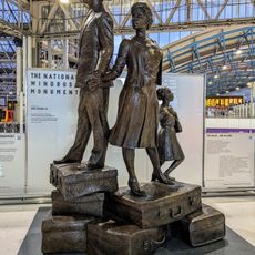
National Windrush Monument
Inggris Raya

National Windrush Monument

104 m
Union Jack Club
Inggris Raya

Union Jack Club

159 m
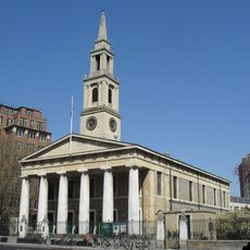
St John's Church, Waterloo
Inggris Raya

St John's Church, Waterloo

67 m
St Patrick's Church, Waterloo
Inggris Raya

St Patrick's Church, Waterloo

142 m
Topolski Century
Inggris Raya

Topolski Century

207 m
Waterloo Station
Inggris Raya

Waterloo Station

95 m
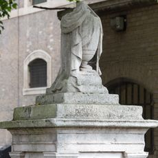
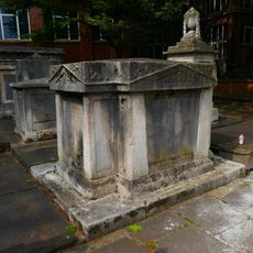
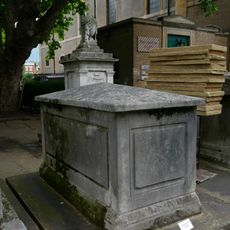
Tomb (With Draped Urn) In Churchyard To North West Of Portico Of Church Of St John With All Saints
Inggris Raya

Tomb (With Draped Urn) In Churchyard To North West Of Portico Of Church Of St John With All Saints

50 m
Edwards Family Tomb In Churchyard To North-West Portico Of Church Of St John With All Saints
Inggris Raya

Edwards Family Tomb In Churchyard To North-West Portico Of Church Of St John With All Saints

39 m
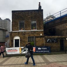
5, Whichcote Street Se1
Inggris Raya

5, Whichcote Street Se1

28 m
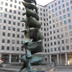
Fountain In Courtyard Of Shell Centre
Inggris Raya

Fountain In Courtyard Of Shell Centre

241 m
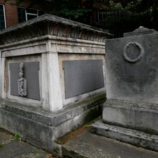
Peache Family Tomb In Church Yard To North West Of Portico Of Church Of St John With All Saints
Inggris Raya

Peache Family Tomb In Church Yard To North West Of Portico Of Church Of St John With All Saints

41 m
26-42, Roupell Street Se1
Inggris Raya

26-42, Roupell Street Se1

178 m
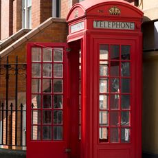
K2 Telephone Kiosk, Outside Cornwall House
Inggris Raya

K2 Telephone Kiosk, Outside Cornwall House

115 m
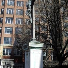
War memorial at St John's Church, Waterloo
Inggris Raya

War memorial at St John's Church, Waterloo

39 m
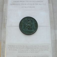
Memorial to the Battle of Waterloo
Inggris Raya

Memorial to the Battle of Waterloo

139 m
43-61, Roupell Street Se1
Inggris Raya

43-61, Roupell Street Se1

217 m
Sharp Family Tomb In Churchyard To North West Of Portico Of Church Of St John With All Saints
Inggris Raya

Sharp Family Tomb In Churchyard To North West Of Portico Of Church Of St John With All Saints

39 m
2-18, Whittlesey Street Se1
Inggris Raya

2-18, Whittlesey Street Se1

208 m
5-21, Whittlesey Street Se1
Inggris Raya

5-21, Whittlesey Street Se1

192 m
Forecourt Walls To Church Of St John With All Saints
Inggris Raya

Forecourt Walls To Church Of St John With All Saints

37 m
Wall on South Side, and Wall, Gate Piers and Gate on East Side, of St John with All Saints' Churchyard
Inggris Raya

Wall on South Side, and Wall, Gate Piers and Gate on East Side, of St John with All Saints' Churchyard

101 m
K6 Telephone Kiosk, Outside Cornwall House
Inggris Raya

K6 Telephone Kiosk, Outside Cornwall House

133 m
22, Cornwall Road Se1
Inggris Raya

22, Cornwall Road Se1

172 m
23, Cornwall Road Se1
Inggris Raya

23, Cornwall Road Se1

163 m
25, Cornwall Road SE1
Inggris Raya

25, Cornwall Road SE1

168 m
95-123, Stamford Street Se1
Inggris Raya

95-123, Stamford Street Se1

189 m
Royal Waterloo Hospital for Children and Women
Inggris Raya

Royal Waterloo Hospital for Children and Women

106 m
Tampilkan peta lengkap
Ulasan
Bagikan pengalaman Anda

Belum ada ulasan

Diskusi
Mulai diskusi...

Belum ada diskusi

« Lambeth Marsh - District on the South Bank in London, England » disediakan oleh Around Us (id.aroundus.com). Gambar dan teks berasal dari proyek Wikimedia di bawah lisensi Creative Commons. Anda diizinkan menyalin, mendistribusikan, dan memodifikasi salinan halaman ini, sesuai ketentuan yang ditetapkan oleh lisensi, selama catatan ini terlihat dengan jelas.

Temukan permata tersembunyi di mana pun Anda pergi!

Dari kafe tersembunyi hingga titik pandang yang menakjubkan, hindari tempat wisata yang ramai dan temukan tempat yang sesuai dengan gaya Anda. Aplikasi kami memudahkannya dengan pencarian suara, filter cerdas, optimasi rute, dan tips orang dalam dari para pelancong di seluruh dunia. Unduh sekarang untuk pengalaman seluler yang lengkap.
Around Us App Screenshot
❝

Cara unik untuk menemukan tempat-tempat baru❞

— Le Figaro

❝

Semua tempat yang layak dijelajahi❞

— France Info

❝

Ekskursi sesuai keinginan hanya dengan beberapa klik❞

— 20 Minutes

Around Us
Panduan Wisata & Peta
Unduh

Kirim ke ponsel Anda

QR Code
1

Buka aplikasi kamera di ponsel Anda.

2

Arahkan kamera ke kode QR. Sebuah notifikasi akan muncul.

3

Ketuk notifikasi untuk membuka tautan.