Beaufort's Dyke, Underwater trench in North Channel, United Kingdom
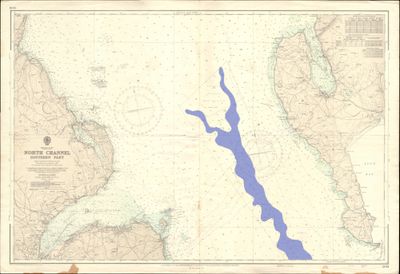
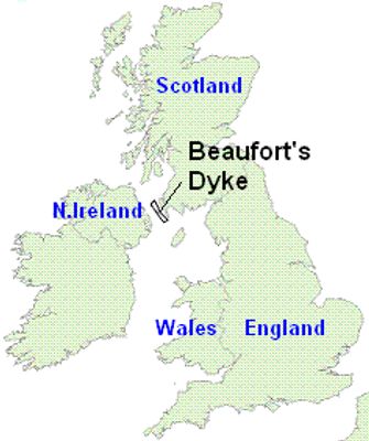
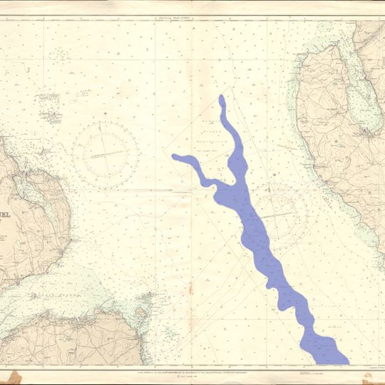
Beaufort's Dyke is an underwater trench running between Scotland and Northern Ireland for roughly 50 kilometers in the North Channel. It forms one of the deepest parts of this seabed, dropping to over 300 meters at its lowest point.
The trench was carved out during the last Ice Age when glaciers scraped and hollowed the seabed between Britain and Ireland. This natural channel has remained largely unchanged since that glacial period.
The trench takes its name from Francis Beaufort, a naval officer whose work shaped how sailors navigate and observe weather. Local maritime communities remain familiar with his contributions to seafaring.
Strong tidal currents within the trench prevent sediment from piling up and shape how vessels must navigate these waters. Understanding local current patterns is essential for anyone spending time near or around this seabed feature.
The seabed within the trench holds over one million tons of military materials deposited between 1920 and 1970. These sunken items include conventional weapons and chemical substances that remain on the ocean floor today.
Komunitas para pelancong yang penuh rasa ingin tahu
AroundUs menghimpun ribuan tempat pilihan, tips lokal, dan permata tersembunyi, yang diperkaya setiap hari oleh 90.839 kontributor di seluruh dunia.